


DIAMONDVILLE RURAL Voting District, Lincoln County, Wyoming
About
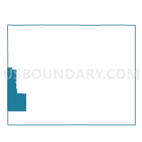
Outline

Summary
| Unique Area Identifier | 698726 |
| Name | DIAMONDVILLE RURAL Voting District |
| County | Lincoln County |
| State | Wyoming |
| Area (square miles) | 409.32 |
| Land Area (square miles) | 409.05 |
| Water Area (square miles) | 0.27 |
| % of Land Area | 99.93 |
| % of Water Area | 0.07 |
| Latitude of the Internal Point | 41.68253250 |
| Longtitude of the Internal Point | -110.76575310 |
Maps


Graphs
Select a template below for downloading or customizing gragh for DIAMONDVILLE RURAL Voting District, Lincoln County, Wyoming


Neighbors
Neighoring Voting District (by Name) Neighboring Voting District on the Map
- ALMY HILLIARD Voting District, Uinta County, WY
- DIAMONDVILLE Voting District, Lincoln County, WY
- FRONTIER Voting District, Lincoln County, WY
- FT. BRIDGER Voting District, Uinta County, WY
- KEMMERER ELECTION PRECINCT NO. 2, Lincoln County, WY
- KEMMERER WEST Voting District, Lincoln County, WY
- OPAL Voting District, Lincoln County, WY
- Randolph North Voting District, Rich County, UT
- Randolph South Voting District, Rich County, UT
Top 10 Neighboring County Subdivision (by Population) Neighboring County Subdivision on the Map
- Evanston CCD, Uinta County, WY (14,613)
- Bridger Valley CCD, Uinta County, WY (6,505)
- Kemmerer East CCD, Lincoln County, WY (4,546)
- Randolph-Woodruff CCD, Rich County, UT (1,038)
- Kemmerer West CCD, Lincoln County, WY (982)
Top 10 Neighboring Place (by Population) Neighboring Place on the Map
Top 10 Neighboring Unified School District (by Population) Neighboring Unified School District on the Map
- Uinta County School District 1, WY (14,618)
- Lincoln County School District 2, WY (13,408)
- Lincoln County School District 1, WY (3,894)
- Uinta County School District 4, WY (3,252)
- Rich School District, UT (2,264)
Top 10 Neighboring State Legislative District Lower Chamber (by Population) Neighboring State Legislative District Lower Chamber on the Map
- State House District 53, UT (37,757)
- State House District 4, UT (28,046)
- State House District 20, WY (10,187)
- State House District 18, WY (9,703)
- State House District 19, WY (8,191)
Top 10 Neighboring State Legislative District Upper Chamber (by Population) Neighboring State Legislative District Upper Chamber on the Map
- State Senate District 25, UT (89,262)
- State Senate District 14, WY (19,890)
- State Senate District 15, WY (16,793)
Top 10 Neighboring 111th Congressional District (by Population) Neighboring 111th Congressional District on the Map
Top 10 Neighboring Census Tract (by Population) Neighboring Census Tract on the Map
- Census Tract 9753, Uinta County, WY (7,761)
- Census Tract 9752, Uinta County, WY (6,505)
- Census Tract 9784, Lincoln County, WY (3,534)
- Census Tract 9501, Rich County, UT (2,264)
- Census Tract 9782, Lincoln County, WY (1,994)